Sekondi-Takoradi (Takoradi)
Sekondi-Takoradi is a city in Ghana comprising the twin cities of Sekondi and Takoradi. It is the capital of Sekondi – Takoradi Metropolitan Assembly and the Western Region of Ghana. Sekondi-Takoradi is the region’s and largest Fante city as well as an industrial and commercial center, with a population of 445,205 people (2012). The chief industries in Sekondi-Takoradi are timber, cocoa processing, plywood, shipbuilding, its harbour and railway repair, and recently, sweet crude oil and crude oil. The fundamental job in Sekondi-Takoradi is fishing. Sekondi-Takoradi lies on the main railway lines to Kumasi and Accra. It is one of the most modern and cleanest cities in Ghana.
Sekondi, an older and larger Ahanta town, was the site of Dutch Fort Orange (1642) and English Fort Sekondi (1682). It prospered from a railroad built in 1903 to hinterland mineral and timber resources. Takoradi, also an Ahanta town, was the site of Dutch Fort Witsen (1665) and has an important deepwater seaport, Ghana's first, built in 1928.
During World War II, RAF Takoradi was an important staging point for British aircraft destined for Egypt. Spitfire fighter planes were shipped in crates from England to Takoradi where they were assembled then flown via Nigeria and Sudan to the war in Libya. 26 Squadron SAAF was also based in Takoradi during World War II, flying anti-submarine and convoy protection patrols over the Atlantic. A number of South African airmen are buried in the Takoradi European Public cemetery.
The cities combined in 1946. On 20 November 1969, the city became the seat of the Roman Catholic Diocese of Sekondi–Takoradi.
The city is currently named (although not officially) as the Oil City of Ghana due to the massive discovery of oil in the Western region and has attracted massive migration from people all around the world. For example, of the 248,680 people in the Sekondi-Takoradi metro area in 2010, some 148,000, or well above half, were indigenous Ahanta people, 30,000 came from the central region of Ghana, 60,000 are from other regions of Ghana and 10,000 are foreign nationals.
Map - Sekondi-Takoradi (Takoradi)
Map
Country - Ghana
 |
 |
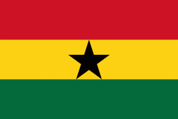
| Flag of Ghana | |
The Bono state existed in the area that is modern day Ghana during the 11th century. Kingdoms and empires such as Kingdom of Dagbon in the north and the Ashanti Empire in the south emerged over the centuries. Beginning in the 15th century, the Portuguese Empire, followed by other European powers, contested the area for trading rights, until the British ultimately established control of the coast by the 19th century. Following over a century of colonial resistance, the current borders of the country took shape, encompassing 4 separate British colonial territories: Gold Coast, Ashanti, the Northern Territories, and British Togoland. These were unified as an independent dominion within the Commonwealth of Nations. On 6th March 1957, Ghana became the first country in Sub-Saharan Africa to achieve sovereignty. Ghana subsequently became influential in decolonisation efforts and the Pan-African movement.
Currency / Language
| ISO | Currency | Symbol | Significant figures |
|---|---|---|---|
| GHS | Ghanaian cedi | ₵ | 2 |
| ISO | Language |
|---|---|
| AK | Akan language |
| EN | English language |
| EE | Ewe language |
| TW | Twi |


